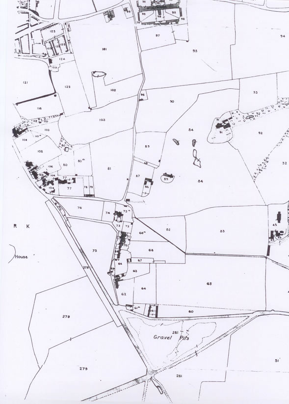
Map 3 1843: Vanbrugh Hill is still an undeveloped country lane. The numbers on each plot of land on this tithe map can establish who owned the site in the early Victorian days.

Map 3 1843: Vanbrugh Hill is still an undeveloped country lane. The numbers on each plot of land on this tithe map can establish who owned the site in the early Victorian days.