
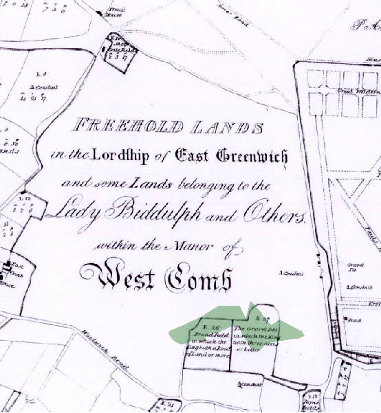
Map 1 1697: the oldest known map of the Westcombe Woodlands , showing gravel pits on the northern edge of the Manor of West Comb. Please note that north is at the bottom of this map. The road junction at the top left hand corner is nowadays the Royal Standard gyratory and Greenwich Park can be seen to the right.